
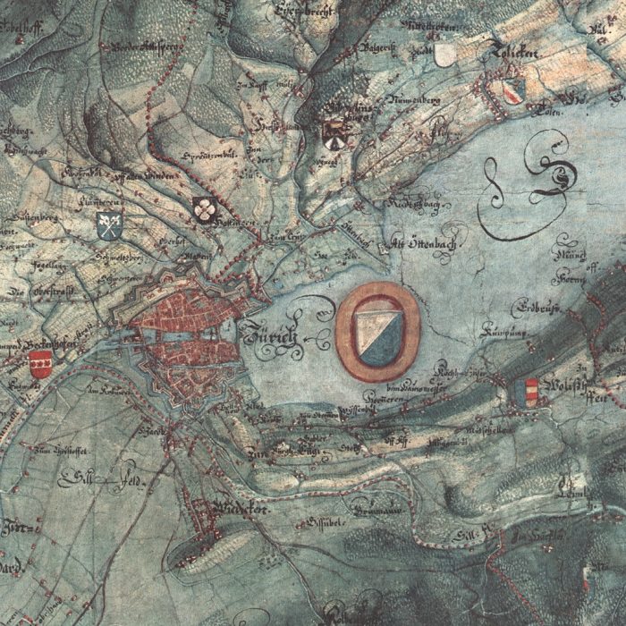
The Gygerkarte, or Gyger Map (and detail), made in 1667 by Hans Conrad Gyger and one of the first ever to represent a landscape in this intricate and accurate fashion.
The Gygerkarte, or Gyger Map (and detail), made in 1667 by Hans Conrad Gyger and one of the first ever to represent a landscape in this intricate and accurate fashion.